Public participation GIS (PPGIS) is usually identified as a method for producing place-based information about human experiences, opinions, and feelings. However, an interesting Maptionnaire example by the Fishery Center of Kainuu Region shows that participatory mapping can be used in creative ways.
The intention of the project was to get more information about the spawning places of zander in Oulujärvi lake. Local fishers were asked to share their expertise with the help of a Maptionnaire questionnaire.
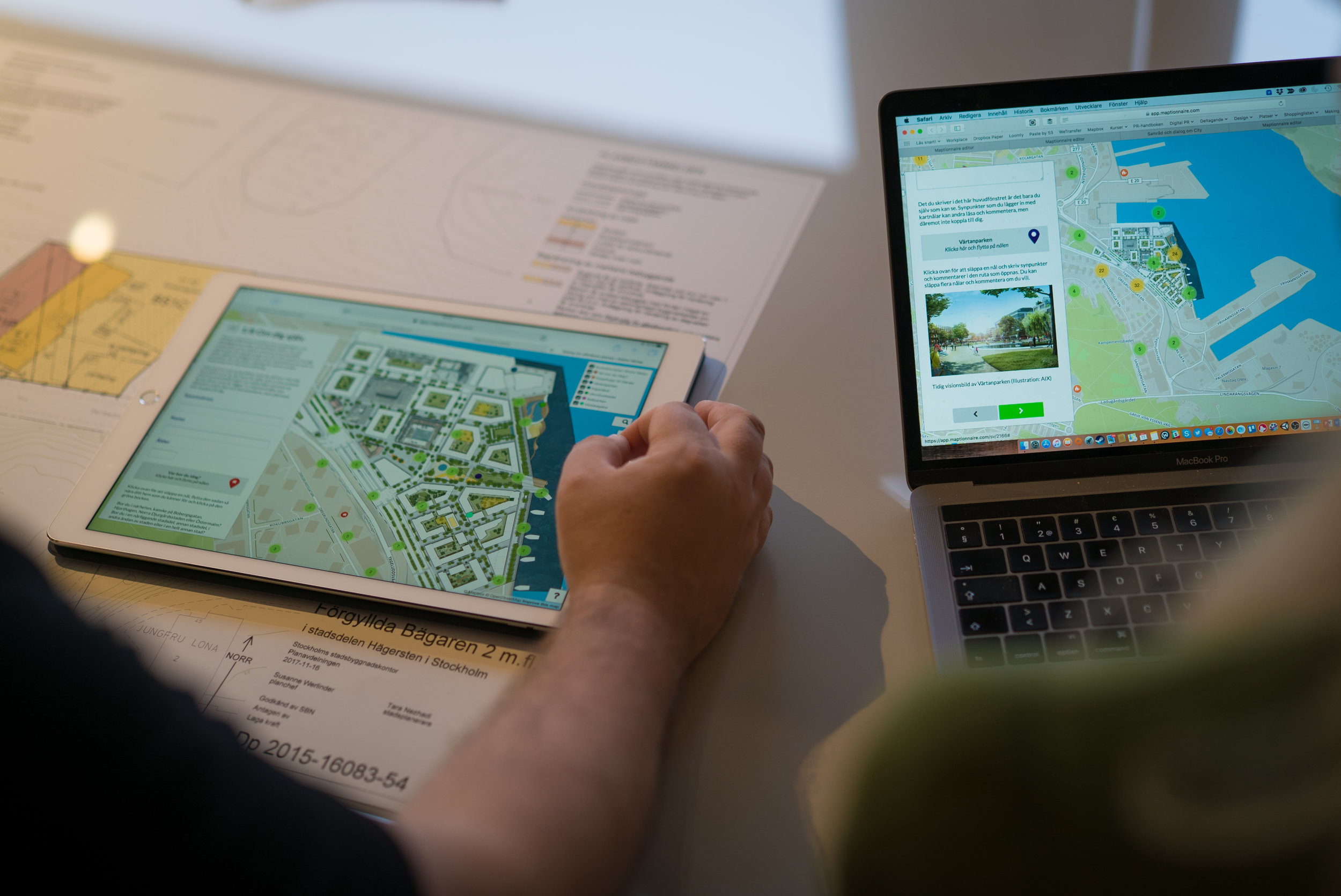
Crowdsourcing with Participatory Mapping Tools
Map-based questionnaires can support traditional fish observation methods such as echo sounding or fishway tracking especially when it comes to research related to socio-economic sustainability.
In the Oulujärvi case, the fishers were asked to mark spawning places on the map that they had observed. Zander has become the most important species around Oulujärvi lake for economical reasons. This is why securing its natural reproduction is a high priority. The fishers were asked about how they think preserving zander could be secured, i.e. how the fishing of zander could be regulated (e.g. regulating the fishing equipment, regulating quotas) and how the spawning season could be protected.
Location-Based Data for Managing Natural Resources
When the goal is to study environmental topics from a human perspective, the Oulujärvi lake case is just one example where qualitative methods prove their usefulness. It’s possible to observe changes in the ecosystem or to collect ideas for the management of natural resources.
Map-based questionnaires enable this kind of research by combining the benefits of hard and soft data: the data can be collected on a large scale and in a digital, geolocated format. At the same time, the data includes qualitative input. It’s also effortless to combine the data with other environmental datasets.
Maptionnaire was beneficial because there was no need to deal with paper and the data was already compiled in an Excel format for further processing. On top of that, we were able to gather valuable information about the spawning places of zander and suggestions on how to regulate fishing. The feedback was given by those people who actually move around the lake and fish.
Jaakko Muurimäki, Fishery Center of Kainuu Region
According to the Fishery Center of Kainuu Region, the questionnaire offered useful information that can be used for organizing the fishery and its operations in the Oulujärvi area.


.webp)