.jpeg)
Why get together at least once a year?
The digital revolution in the land use planning sector has brought the Maptionnaire team together. The service was designed to facilitate planners and researchers to connect with those that traditional methods of participation couldn’t reach. However, despite that our team’s identity is very “digital”, we also strongly support the need to experience live human interaction. After all, until the past century, human beings had little chances to communicate with those who were not present physically. Our brains haven’t evolved as fast as technology has.
When it comes to the social science of participation itself, we are strong believers that using a mix of tools that includes digital services is the way to go. However, the traditional methods, such as events or public meetings, should not be discarded. Face-to-face interaction adds a lot of value to any process, especially when planning with people.
As a company, we try to follow a similar approach. As of 2014, we have annually invited the Maptionnaire Community to get together at our Summer Day event. The idea is to share project experiences, ideas, and, very importantly, many stories and laughs.
In 2018, we hosted the Summer Day at our new office. The participants had the pleasure of learning about different types of projects from a few of the organizations we work with. Presentations were given by Hannele Selin from the city of Järvenpää, Timo Hokkanen from the North Karelia Biosphere Reserve/Koitajoki project, Nora Fagerholm from the University of Turku, and Laura Malm-Grönroos and Seija Lonka from the city of Espoo. In addition, our Maarit shared a few words about the Herttoniemi Neighborhood Vision consultancy project we’ve worked with.
Participatory Maps for Decision-Makers
Hannele talked about how Järvenpää’s administration has experimented with Maptionnaire when interacting with decision-makers. They have used map-based questionnaires in a workshop-like setting to gather quick reactions from city council members for structuring the discussion. This has helped the administration to capture and visualize the feeling in the room on complex topics, such as new infill development sites. In Hannele’s experience, this has been a useful method to activate and prep decision-makers for more in-depth discussions.

Cultural and Natural Values of the Koitajoki River Area
Timo discussed how they had used our service in their project to crowdsource the important values of the Koitajoki river basin area. He mentioned that Maptionnaire proved to be a very useful tool for gathering people’s insight in a sparsely populated area. They managed to get nearly 1,000 map markings from around 300 respondents, both numbers that would have been impossible to achieve otherwise.
Maptionnaire and Maritime Spatial Planning
Nora Fagerholm offered case studies on how Maptionnaire can be applied in the sustainable planning of coastal and marine environments. In a region on the west coast of Finland, they have collected people’s input on the state of the coastal area to guide the drafting of a plan to improve its recreational use. In Zanzibar, similarly, Maptionnaire has been used to enable government officers and other stakeholders to map coastal opportunities and threats. These findings were merged together with opinions from village residents and incorporated into a coastal spatial plan.

Automating Planning Feedback
Laura and Seija spoke about a joint development project between Espoo and us to integrate Maptionnaire’s pdf reporting feature to Espoo’s urban planning feedback system. As a result, when residents use Maptionnaire to comment on Espoo’s land use plans, their results can be automatically summarized and sent to the city’s registry office to be processed as their official statement. The project proved to be successful and it helps make city governance more efficient.
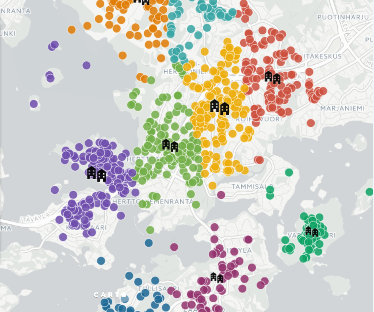
Herttoniemi Shared Vision
Finally, Maarit told how Maptionnaire has been used in a project to empower the residents of Helsinki’s Herttoniemi neighborhood and the city administrators to co-create a shared vision for the future of the area. A map-based survey was an important part of the project to make sure that everyone in the neighborhood gets a chance to participate in the process. And many did. We managed to involve over 2,000 residents to share their vision.
Our Summer Day programs aren’t long, but we try to use our time efficiently. We are also thinking about hosting similar events abroad in the future. Let us know if you would like to collaborate in bringing Maptionnaire to your area.
As for this June’s event, you can enjoy the pictures below taken by our own Andy.
You can also get into the mood and enjoy the recording from our last summer meetup where the cities of Stockholm and Helsinki share their experiences with Maptionnaire.


.webp)

.jpeg)
-min.jpeg)
.jpg)


.jpeg)


.jpeg)


.jpeg)


.jpeg)
.jpeg)
.jpeg)