The City of Helsinki has set an ambitious aim to be the most functional city in the world. One core dimension of this vision is improving walkability in the city center.
To start a dialogue with residents about the vision, Helsinki decided to open a walkability survey. In this survey, residents assessed the current state of walkability in the city center and where it could be developed. Their idea was to provide an effortless way for citizens to get involved in the planning process already early on.
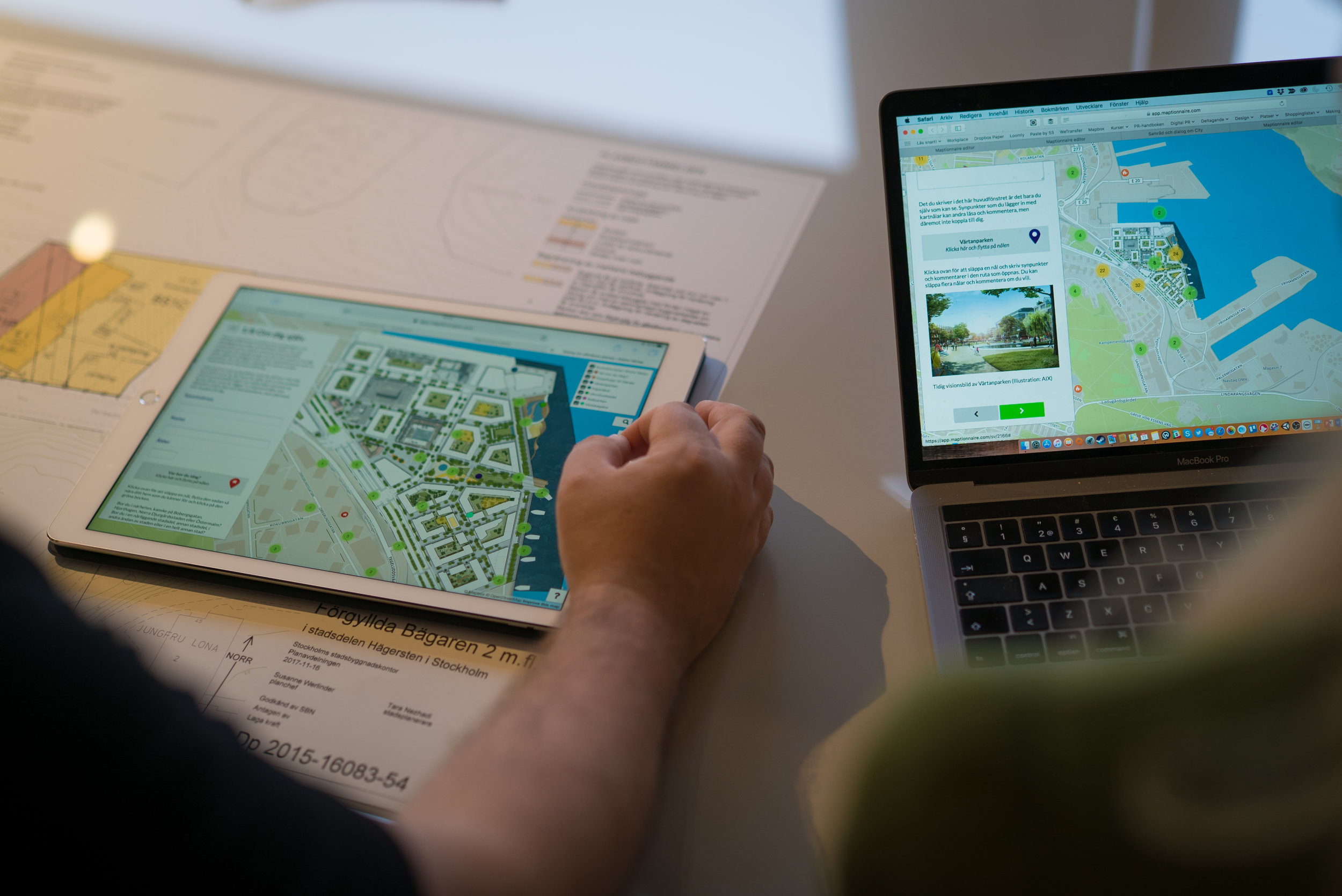
Co-creating The Walkability Study with Maptionnaire
Maptionnaire was hired to co-create a walkability survey with Helsinki’s planning experts, and after the data collection phase compile a report of the results.
The project was launched in 2018 with a workshop for designing the contents of the survey together with a group of architects, city planners, participation coordinators, and mobility researchers working for the city.
Once their diverse wishes were combined, the survey included questions about e.g. the everyday movements of pedestrians, people’s wishes for improvements, and the plans the city already had underway.
Read more about how Maptoinnaire can be used for a walkability study (to get pedestrian movement data), for a nationwide health survey that analyzes moving habits, and in transportation & mobility projects in general.

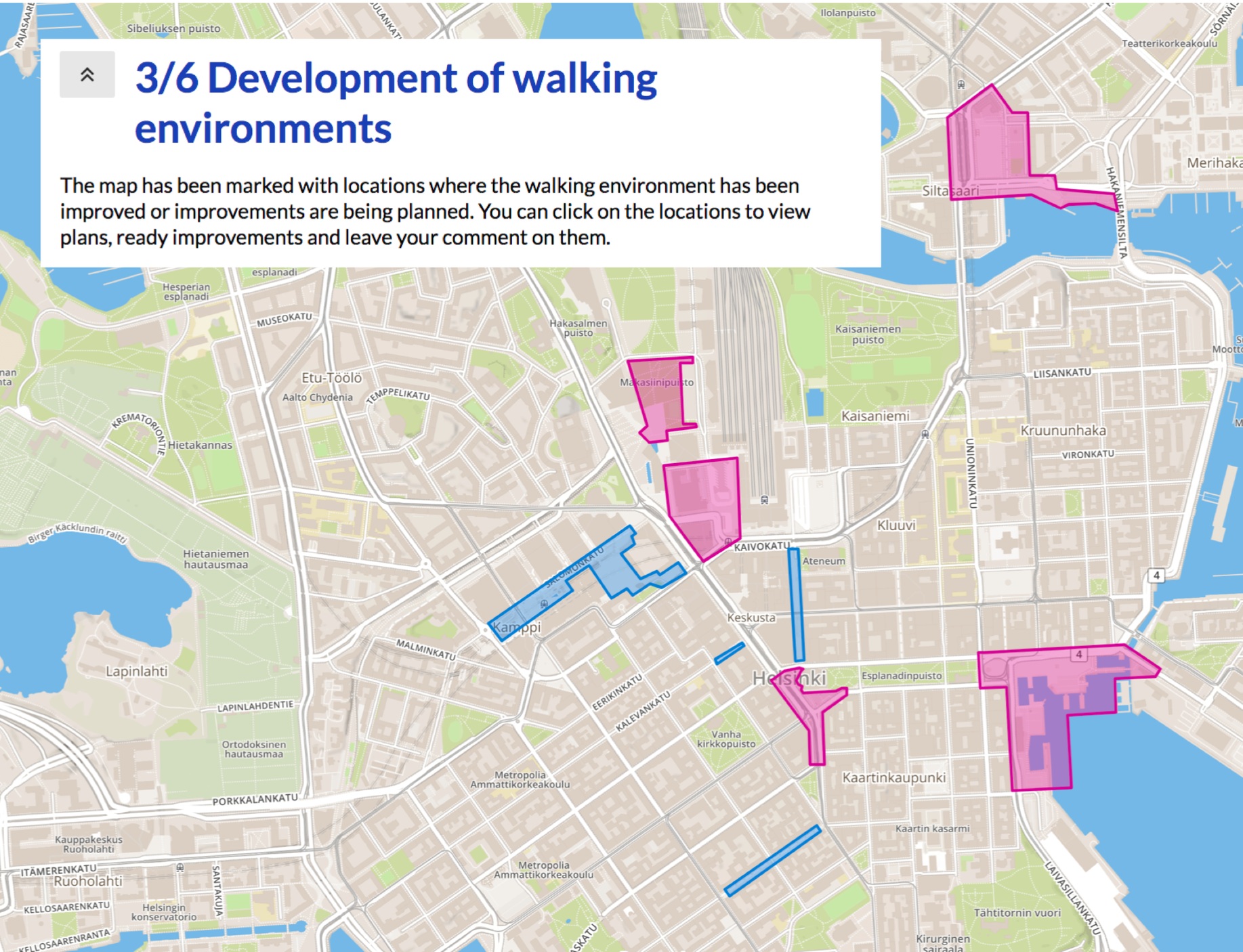
Besides receiving information about the highlights or unpleasantries of people’s walking routes, we also consider the areas with no markings at all valuable for the project.
Anu Hämäläinen, Participation Planner, City of Helsinki
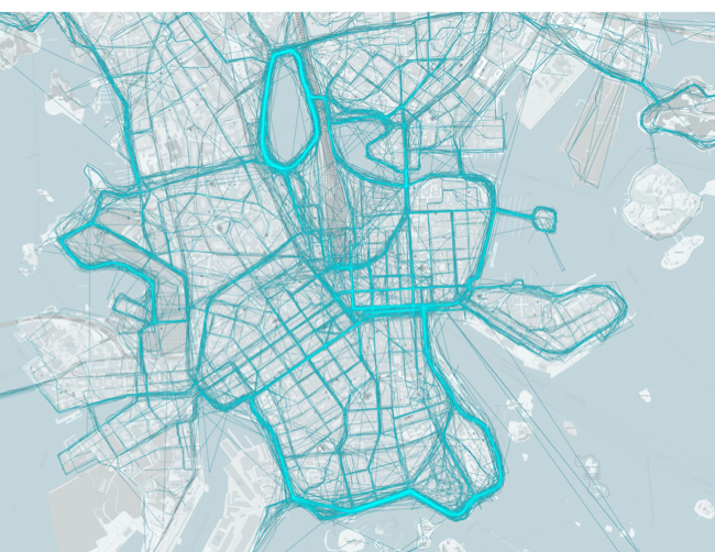
1600 Respondents & Over 8700 Marked Routes
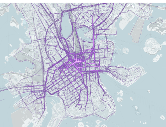
Ultimately, the walkability survey attracted 1600 respondents to mark over 8700 routes and places on the map. The results have provided the city with useful information about the diversity of pedestrian routes and the reasons why people choose to walk along certain routes.
900 responses were related to routes that need improvement in people’s opinion. The planners found that as a positive surprise. Most suggestions were related to reducing car traffic in the city center and increasing the safety of cross-walks.
The survey’s results will serve as the foundation for Helsinki’s walkability development program. So far, the results have been used as background information in a study about the possibilities of building an underground collector street, in a study on the enlargement of the pedestrian areas in the city center, as well as in the visioning work for the city center.
The map-based survey supported the citizens’ possibilities to show their everyday routes well. It was possible to answer in three languages and via mobile devices. In addition, the user experience was effortless and inspirational. We believe the survey helped us reach quite a few of those citizens who wouldn’t have joined the public meetings and workshops that we organized.
The map survey was set up quickly and Maptionnaire’s consulting expertise in formulating the questions and taking care of the analysis was a big help for us. Resources-wise, we feel that a co-designed survey was a very efficient way to collect information from a large crowd within a short period of time.


.webp)