Health Geography studies the nature of relations between health and space. It applies geographical information — including Public Participation GIS — to understand spatial trends in health, disease, and well-being.
Adeline Gabriel used Maptionnaire to demonstrate to Melbourne University’s Health Geography class how spatial analysis could be used effectively to map health-related experiences.
The blog post is written by Adeline Gabriel – a student at the University of Melbourne. Adeline used Maptionnaire as a participatory research tool to map health-related experiences on her campus.
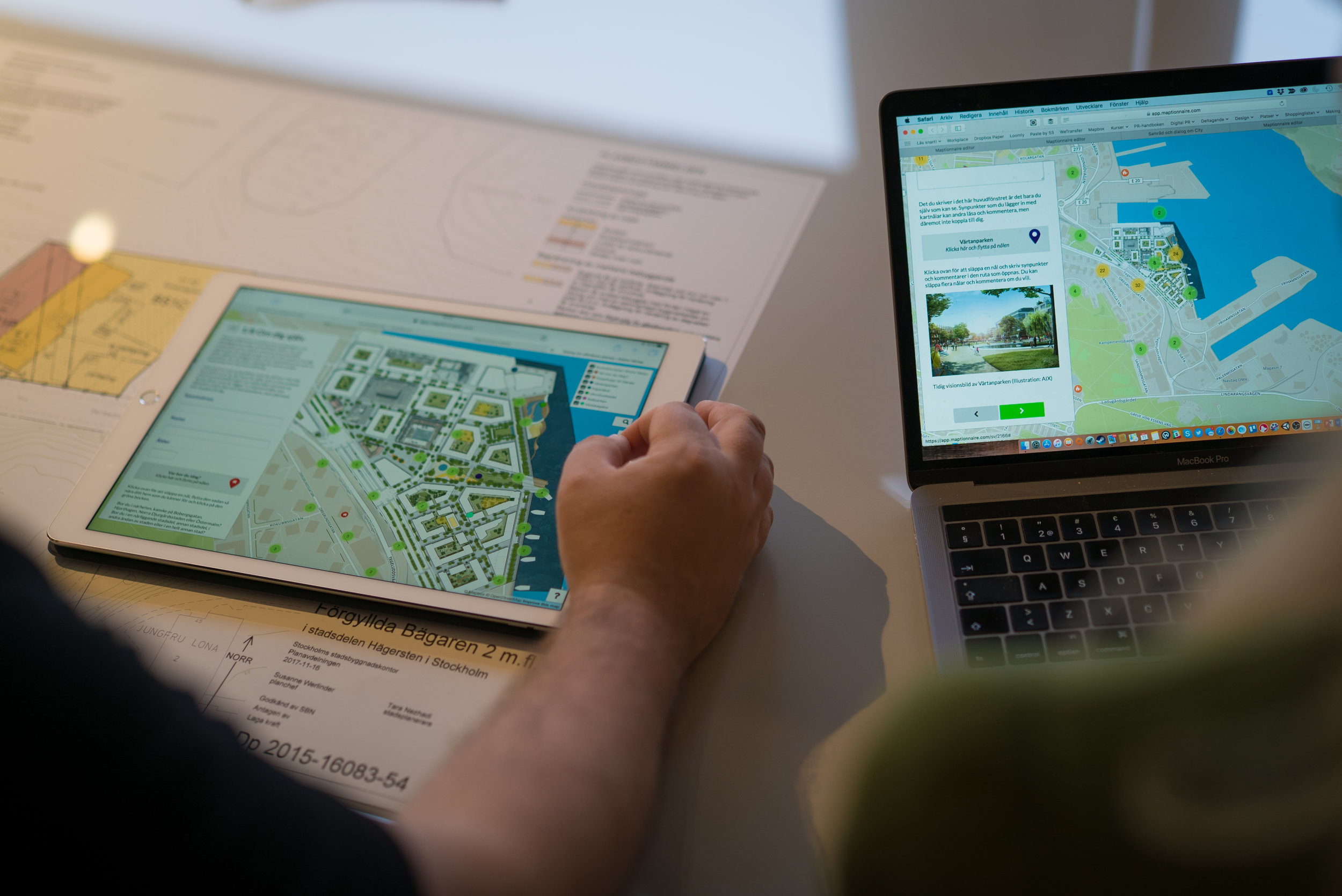
Maptionnaire as a PPGIS Research Tool
The strength of PPGIS (public participation geographic information systems) like Maptionnaire is their ability to link layers of data for statistical and spatial analysis and to communicate important correlations, trends, and patterns.
In terms of effective data visualization, Maptionnaire is an interface between real-world experience and diagrammatic representation. Maptionnaire is a strong example of a GIS program that allows for easy geocoding, collecting spatial data from participatory sources and pinpointing them on a map.
This not the only GIS function of Maptionnaire, but it is it's most fundamental. Maptionnaire is also a great example of the analytical function of GIS, making it easy to identify correlated data layers.

Applying PPGIS for Health Geography Studies
My study addressed the capabilities and uses of GIS more broadly, focusing on Maptionnaire as a practical example of how PPGIS (public participation GIS) can be usefully employed in Health Geography studies. I created a simple Maptionnaire questionnaire to collect qualitative, voluntary data on people’s well-being related experiences around the University of Melbourne campus.
It was very similar to the questionnaire used in ‘Maptionnaire Analysis Tool Basics’ tutorial available in the User Guide. I asked for participants to identify locations they had had a positive or negative experience on campus, to describe that experience and to rate the intensity of that experience.
By doing so, I was able to demonstrate to my class one means of sourcing data for GIS studies: through voluntary participants. A discussion ensued around the logistics of this form of data collection; one of its strengths is the acquiring clear qualitative data from a community. It has limitations in the accuracy of the public’s mapping abilities and the ethics concerning confidentiality and privacy of that information (but Maptionnaire takes data privacy and security seriously).

The Benefits of Public Participation and Spatial Analysis in Health Geography
I found the correlation between Health Geography and PPGIS like Maptionnaire to be astoundingly evident. PPGIS has the capacity to clearly communicate patterns and correlations in data, and by doing so has an important role in shaping public policy, urban planning and decisions that affect wider communities.
I could envision technology like Maptionnaire being used to identify unsafe or unfriendly parts of a city, to identify a popular place for the site of a health care service or to gauge the effectiveness of parks and public spaces in the well-being of the public.
I think many companies, councils or institutions emphasize the importance of wider community input in decision making, but few act effectively on this. Maptionnaire is the perfect community engagement platform to facilitate this.
Although the example study I conducted in the class had relatively few participants and data points (24 respondents and 137 map responses), it would be a very easy process for the University administration to conduct the same survey on a wider scale.
Read about Maptionnaire being used to study perceived safety in Moncton, Canada.
Maptionnaire for Health Geography and Safety Analysis: Results
At a University with 42,000 students, our individual voice is rarely heard or considered, but each data tag on Maptionnaire is an indication of one of those voices. Programs like this would allow the University to gain important insights into students’ interactions with the campus.
My survey, though small, already showed clear commonly shared sites of negative or positive experiences. For example, the Student Help Service — all negative experiences; the South Lawn — very positive experiences. My professor was impressed by my small-scale study and has taken up the suggestion for the Geography faculty to conduct a wider survey of the student body to continue to teach and use geospatial technologies in a collaborative, interactive way.
Maptionnaire is one of the most user-friendly, effective and informative platforms to collect Geospatial data so I’m sure they will be seeing more use from the University of Melbourne in the future.
Maptionnaire has also been used at HAS University in Netherlands to introduce future GIS experts to public participation and soft data in the Smart Regions course. Are you also interested in using Maptionnaire for regional development or educational projects?


.webp)