

Public consultations help planners unearth invaluable data about residents' current mobility preferences and what they want from the future infrastructure. Since the goal of The Active Way project from St Andrew is to change people's behavior—to opt for active mobility instead of driving a car for shorter trips within the town—the design must reflect local perspectives.
In this project, Maptionnaire was used for a map-based consultation, enabling planners to design and prioritize community-centric active travel solutions.
The Active Way: Bringing Active Travel to St Andrews
St Andrews is not a big town—about 18,000 people reside there permanently. But due to its prestigious university, picturesque beaches, and famed golf course, the number of people who spend time there fluctuates a great deal: in pre-covid times, almost one million tourists visited St Andrews annually.
Despite being a compact town, St Andrews's current infrastructure does not encourage active travel. A lot of traffic goes through the city center, making a lot of streets unsafe. Although crossing from one side of the city to the other is only a 13-minute bike ride or a 30-minute walk, many residents still choose cars.

The Active Way is there to change the town: this community-led project aims at making wheeling, cycling, and walking in St Andrews a safe and enjoyable choice for as many locals and guests as possible.
The project is funded by the UK-wide charity organization Sustrans' “Places for Everyone” initiative, which employed the consultancy firm Cycle Path Services for planning public consultations, analyzing insights, and translating them into route options before creating an actual design plan. Community engagement is an integral part of these initiatives as the proposed interventions should address the real pain points and support locals in their mobility choices.
In a nutshell, the consultation and design process consisted of these steps:
- Organizing a pre-planning consultation with a traditional survey to gague local support for the initiative
- Announcing results and giving feedback
- Running a second map-based consultation using Maptionnaire to ask about local mobility barriers and spots for future interventions
- Announcing results and giving feedback
- Drafting the plan based on residents' feedback
- Showing the draft with proposed interventions to locals
- Achieving an agreement during a public hearing
- Implementing the interventions
The consultations made the initiative transparent for locals and ensured that everyone had an opportunity to share their opinions. What's more, this grassroots data on community insights and feedback directly impacted proposed interventions. This process ensured that the result truly helped residents choose active travel.
Let's unwrap the consultation and design process in more detail.
Gauging Support with a Pre-Planning Public Consultation
The first pre-planning public consultation surveyed the attitudes of locals towards active mobility and Low Traffic Neighborhoods. For example, how frequently would you bike if streets were safer? Is it realistic that you'd walk to school if the route is less noisy? What prevents you from walking, cycling, and wheeling for work or leisure right now?

This early-stage consultation had several important functions:
- Planners and activists received support from locals for prioritizing active travel.
- Planners got initial ideas of how often and why people travel—and what prevents them from doing so.
- Residents learned about the project and upcoming changes (even if not yet tangible) and felt included in the city planning process.
What's more, planners learned that the key barrier—relevant for many places where Cycle Path Services worked before—was traffic safety. This was the number one issue to address in the new plan.
Understanding Spaces, Habits, and Barriers during a Map-Based Consultation
Biking feels unsafe, but where exactly? Where did near-misses happen due to insufficient street lights? Which routes are used the most because of the beautiful scenery? A traditional survey won't be of any help when trying to understand the built environment. You need to add a spatial component to each and every answer.
That's why Maptionnaire was used for the second public consultation—to connect experiences with places and understand where exactly the changes should take place.
.webp)
For example, the first consultation revealed that 73% of respondents support the introduction of Low Traffic Neighborhoods in St Andrews. Maptionnaire enabled planners to go one step further and learn where these neighborhoods would be welcome and what sort of problem they'd solve.
With Maptionnaire, Cycle Path Services created a map-based survey that collected data from residents about their mobility preferences. In addition to map-based questions, Maptionnaire is fully suited for voting and creating traditional surveys.
More specifically, the residents pointed out on the map:
- Favorite outdoor public spaces
- Problematic spaces
- Locations of near-misses
- Often used routes
- Routes residents don't use but would like to
- Suitable areas for Low Traffic Neighborhoods
→ How could Maptionnaire benefit your mobility planning projects? Discover the benefits of map-based and digitalized community engagement in transportation planning.
Analyzing the Results
The second round of community engagement generated a vast amount of data on where problems are located and what changes are needed. Overall, more than 300 people answered the map-based survey. Compared to the capacity of a single town hall meeting, a digital survey engages several times more people.
So what do you do with this data in your hands? Crispin from Cycle Path Services shares that it's important not to get stuck with a spreadsheet but actually conduct a spatial and statistical analysis of responses.
In Maptionnaire, each map-based answer and background question receives geographic coordinates—this allows planners to map out, quantify, and visualize various responses filtered out by demographic data or specific answers. Crispin exported the resulting data into GIS software, but you can do similar visualizations with Maptionnaire's analysis tool.
How did this data give direction for active travel initiatives? For example, Cycle Path Services learned about more than 600 favorite outdoor places in St Andrews–mainly clustered along green areas in the inner city and the coast in St Andrews–and why these places were favorable (greenery, beautiful views, peacefulness). They also mapped which routes were the most used in different situations.

Similarly, residents reported 600 negative places. In a follow-up pop-up question, respondents were able to expand on why this place is dangerous, with the most common reasons being fast traffic and the lack of walking or cycling paths.
These identified places are going to be targeted with the interventions, and this grassroots data helped planners find these lovable and problematic spots to later validate why the interventions are needed.

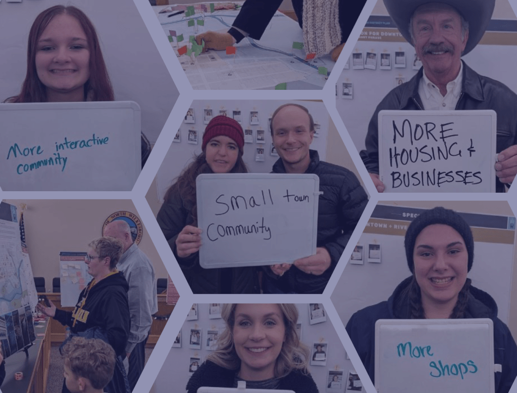
Engaging Residents to Take Part in Planning Consultations

St Andrews is a difficult place to engage with. There is so much going on in the city, and residents get tired of constant requests and can miss a meaningful civic participation opportunity in an avalanche of other options. But Cycle Path Services and The Active Way project managed to engage with a large number of residents.
They used social media alongside more “old-fashioned” outreach tactics, like going out and speaking to locals. But to begin with, not that many young people participated online or in meetings. So the planners and volunteers went to a few places where students typically hang out—for example, a queue for lunch. Students received fliers with a QR code to a map-based consultation, and the incentive was a £50 prize draw. It worked especially well with the younger generation and, coincidentally, it was a student who won the prize.
At every stage of the project so far from online surveys to map-based public consultations and proposed route intervention options, people who live, work and study in St Andrews have been immensely responsive to our calls for input.
The Active Way, St Andrews
Closing the Feedback Loop
The map-based consultation, together with the first survey and other work the planners did, informed the design stage and the route proposal.
The key problem discovered during the public consultations in St Andrews was road safety. Sustrans advised that cycling paths should be safe for unaccompanied 12-year-olds. That's an important criterion, establishing a level of safety required from town planning interventions.
But sometimes these problematic spaces pointed out by residents cannot be eradicated. For example, a busy street with an unsafe painted bike lane that's rendered useless because of on-street parking. Unfortunately, the Council won't prohibit street parking there. So, the solution is to prioritize a different route in the plan, making it safer and more lucrative for cycling, walking, and wheeling.
All of this data, with clear and easy-to-grasp visualization, was included in the report shared with the locals on social media and during an in-person consultation event.

Takeaway: No Active Travel without Community Engagement
- To prioritize active travel solutions, the planners first needed to understand the status quo (current barriers, favorite routes) and wishes for the future (new routes, locations for Low Traffic Neighborhoods).
- With a series of public consultations, Cycle Path Services gained crucial data from residents and used it in subsequent planning and intervention suggestions for The Active Way project.
- While the first consultation gauged locals' support for active travel, the second consultation done with Maptionnaire generated geolocated data about current mobility patterns and future intervention options.
- These insights were continuously shared with the local community and informed the design of future interventions.
This is an excellent blueprint for running a public consultation in active mobility planning. Community members should be at the heart of active travel interventions, and only then will it become an obvious choice that leads to environmental well-being, safety, and happier lives.
Many thanks to Dr. Crispin Hayes from Cycle Path Services for sharing the story!


.jpeg)
.webp)

.webp)


.webp)
.png)


